
🎉 Happy GTA 6 day! 🎉
News3 min read
How MVT Fredericton Built Its 3D City From GeoNB LiDAR
Reported and fact-checked by NB Tech News staff; drafted with AI assistance. How we use AI


Building heights measured by laser, a 1 m terrain model from 26 billion LiDAR points, 15 cm aerial photos and measured river soundings: the open provincial data under the game's new 3D preview, and the same 3D map to explore. Disclosure: NB Tech News, MVT Fredericton and Maps of New Brunswick are all run by A&O.
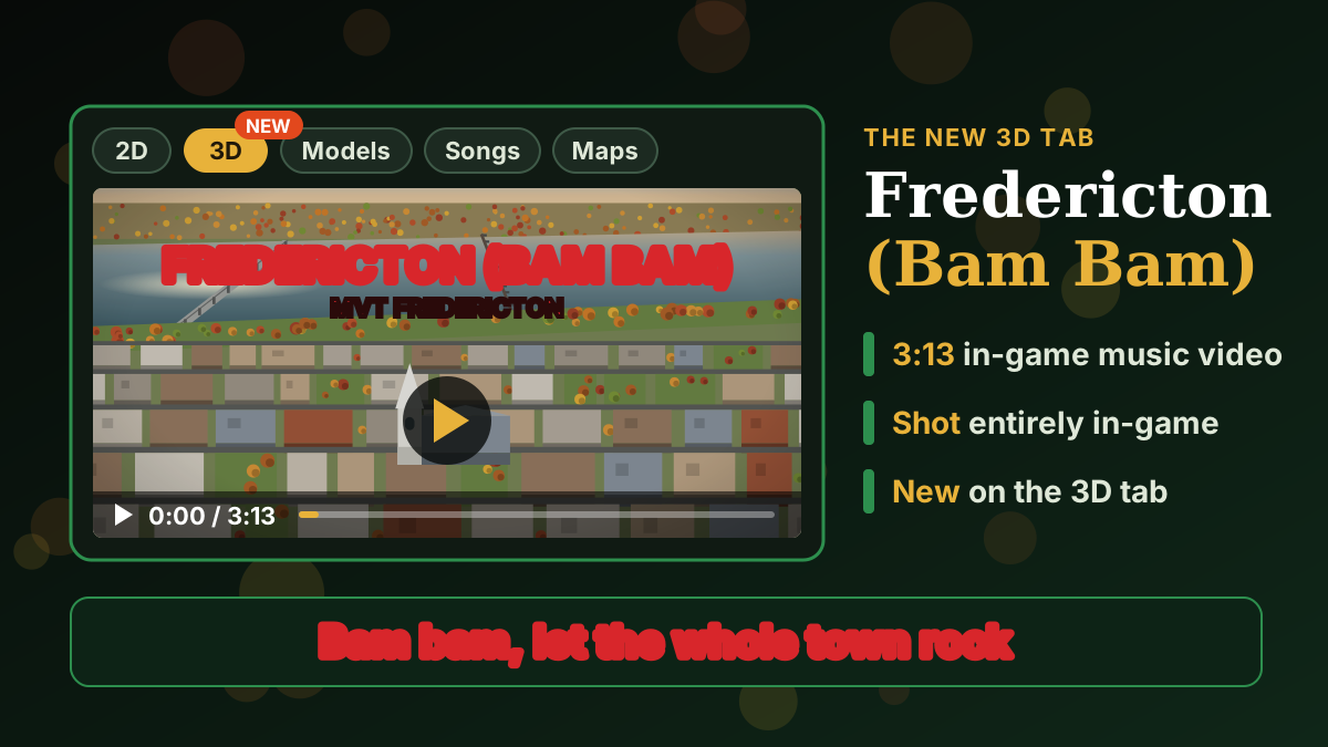
MVT Fredericton opened its 3D tab today with Fredericton (Bam Bam), a three-minute music video shot entirely inside the game. The city in it is not drawn by eye. Its building heights, ground, trees, streets and riverbed come from New Brunswick's own open survey data, processed through Maps of New Brunswick, an open-source catalogue and viewer of the province's geodata.
It launched on the release day Rockstar Games set for Grand Theft Auto VI. MVT Fredericton is not affiliated with Rockstar Games.
This is the same 3D map as the game's Maps tab: GeoNB's aerial imagery underneath, and every downtown building standing at its LiDAR-measured height. Drag to look around; zoom with ctrl-scroll or a pinch.
26 billion laser returns
The survey is GeoNB's 2024 airborne LiDAR, published as 1 km tiles of point clouds. Each tile carries about 20 laser pulses per square metre and arrives fully classified into ground, vegetation, buildings and water.
Maps of New Brunswick's LiDAR pipeline downloaded all 414 tiles that touch the Fredericton city boundary on October 20: 166 GB of compressed point clouds holding 26.3 billion points. It kept the 4.4 billion ground and water returns and binned them into a 1 m bare-earth terrain model of the whole city. Processing took about 89 minutes on a single workstation.
The game's ground comes from that survey. Its trees do too: a 2 m canopy-height model built from the same 2024 LiDAR places each tree and sets its height.
Building heights: roof minus ground
GeoNB also publishes LiDAR-derived building footprints, each with a measured roof elevation and ground elevation. The map above extrudes every footprint by the difference between the two.
The footprints ship as one file. Maps of New Brunswick bakes buildings, roads, wetlands and elevation contours into a PMTiles archive, a single-file vector tile format that a browser reads in pieces with HTTP range requests. The Fredericton file holds 1,308 tiles across zoom levels 10 to 16 in about 8 MB. It needs no tile server: MapLibre draws it straight from MVT Fredericton's web host, and the imagery under it streams from GeoNB's own basemap service.
Imagery, roads, trees and the riverbed
- Imagery. GeoNB's latest orthophoto contribution covers 13,000 km² at 15 cm per pixel, flown in summer 2025, and the basemap under the map above.
- Roads. The streets are the New Brunswick Road Network (NBRN). Each segment carries its real name, lane count, speed limit and direction of travel, which the game's traffic and routing follow.
- Trees. Species come from the City of Fredericton's inventory of 21,186 city-managed trees and GeoNB's provincial forest inventory, so autumn colour changes species by species.
- The riverbed. The Wolastoq has a measured bottom. The Fredericton reach is sampled from the Canadian Hydrographic Service's NONNA bathymetry: 2,388 depth samples along 35 cross-sections, with the channel mostly 2 to 8 m deep.
Maps of New Brunswick
The data work sits in Maps of New Brunswick, an open-source repository with an MIT licence on its code. It catalogues the province's open map sources, with small pipelines to pull and clean them. Its viewer, in English and French, offers property parcels with assessment lookup, 17 imagery vintages from 2014 to 2025, 1 m LiDAR terrain with elevation profiles, flood hazard mapping, protected natural areas and CHS river depths.
Under the hood
The 3D game is built in Godot 4.7 and written in GDScript, with about 500 automated tests. Landmarks such as Christ Church Cathedral, Wilmot United and St. Dunstan's are Python scripts that build low-poly models in Blender; the Cathedral's exterior is 3,940 triangles. The anthem was generated with Suno from in-house lyrics, and the video was shot from scripted in-engine camera moves, with captions timed to the song using Whisper.
Sources
- MVT Fredericton — Maps tab — the 3D map; building heights, terrain, imagery, roads, trees, riverbed
- Maps of New Brunswick — LiDAR pipeline — the Oct. 20 full-city run: 414 tiles, 166 GB, 26.3 billion points, 1 m terrain model
- Maps of New Brunswick — catalogue entries for LiDAR, orthophotos and river depths
- Maps of New Brunswick repository and viewer
- CHS NONNA bathymetry and GeoNB — the source data portals
- fredericton.pmtiles, PMTiles and MapLibre — the map file, its format and its renderer
- Fredericton (Bam Bam) — the video
- Engadget — GTA VI's November 19, 2026 release date
ChronologyGames· 4 stories since Jul 22, 2026
- How MVT Fredericton Built Its 3D City From GeoNB LiDAR (this story)
- Eleven New Brunswick Indie Games You Can Find on Steam
Chronology · show all 4 storiesShow fewer
Related coverage
News · August 26, 2026
InteractiveNB and Spandrel Take New Brunswick Studios to Gamescom
Startups · November 15, 2026
Eleven New Brunswick Indie Games You Can Find on Steam
News · November 17, 2026
UNB's DataNB Says a Military Health Platform Is Feasible — If Trust Is Built
Comments
Loading comments…